Traditional vs. 44moles
|
Traditional |
44moles |
| Time per plot |
30 min |
1.5 – 5 min |
| Trees measured |
6 – 8 (sampled) |
25+ (every tree) |
| Crew needed |
Multiple people, chainsaws, felling |
One person, one scanner, no cutting |
| Data you get |
Spreadsheet, one diameter per tree |
Digital twin, multiple diameters, 3D view |
| Check the work |
Return to the forest |
View 360° images from your desk |
One scan captures 80 trees in 75 seconds. Data uploads automatically.
You review results the same day.
Field crews are harder to manage than trees
Crews leave. Measurements vary by person. Weather delays cost time and
money. Every crew turnover risks data quality drifting.
With 44moles
-
Smaller crews, more work. One person with a scanner
replaces a multi-person team.
-
Real-time progress. The DFI dashboard shows which
plots are scanned, uploaded, and reviewed — no one drives back to the
site.
-
Safer work. No chainsaws, no tree-felling, no
navigation hazards.
What the data looks like
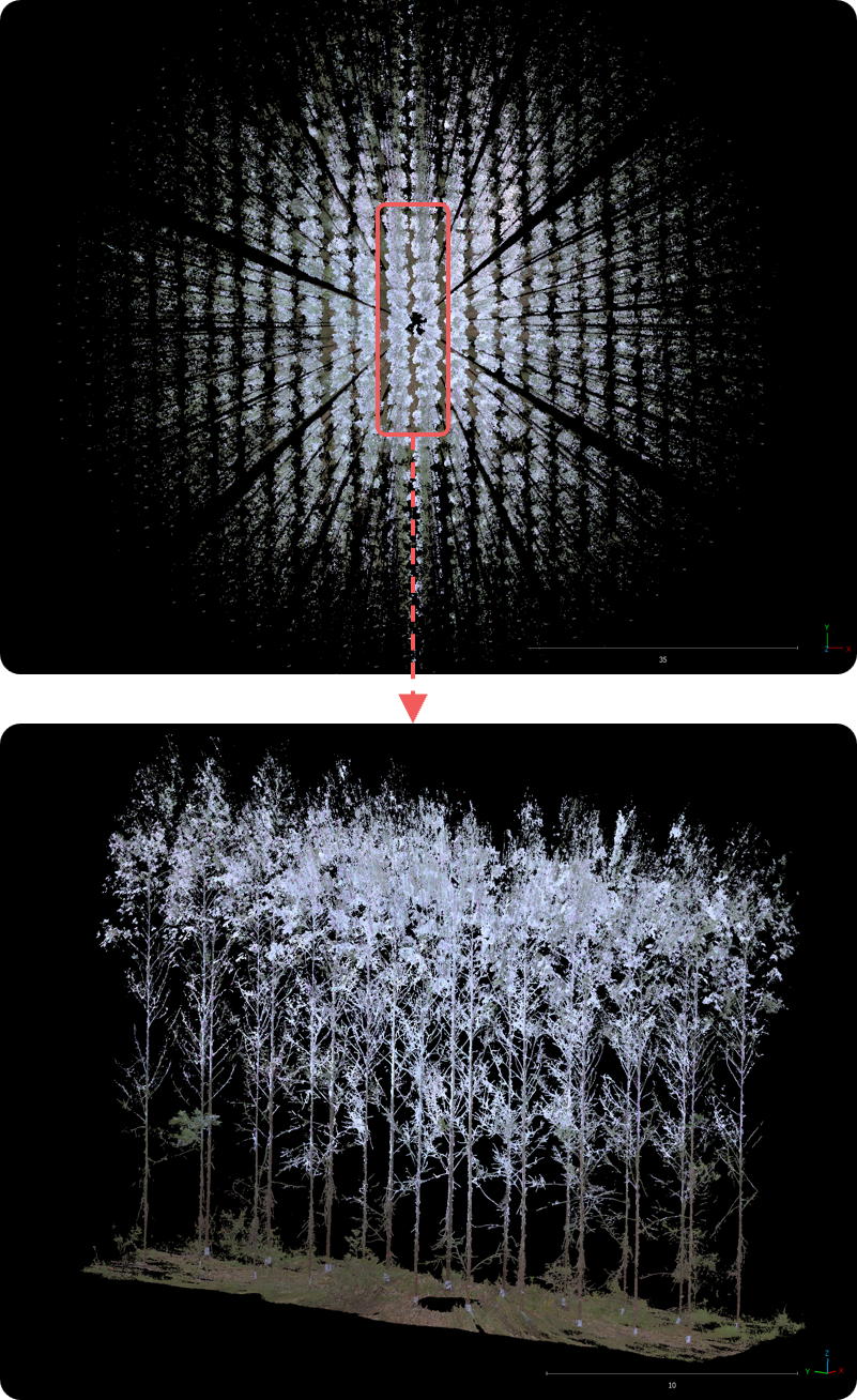
Top-view LiDAR scan of a forest plot
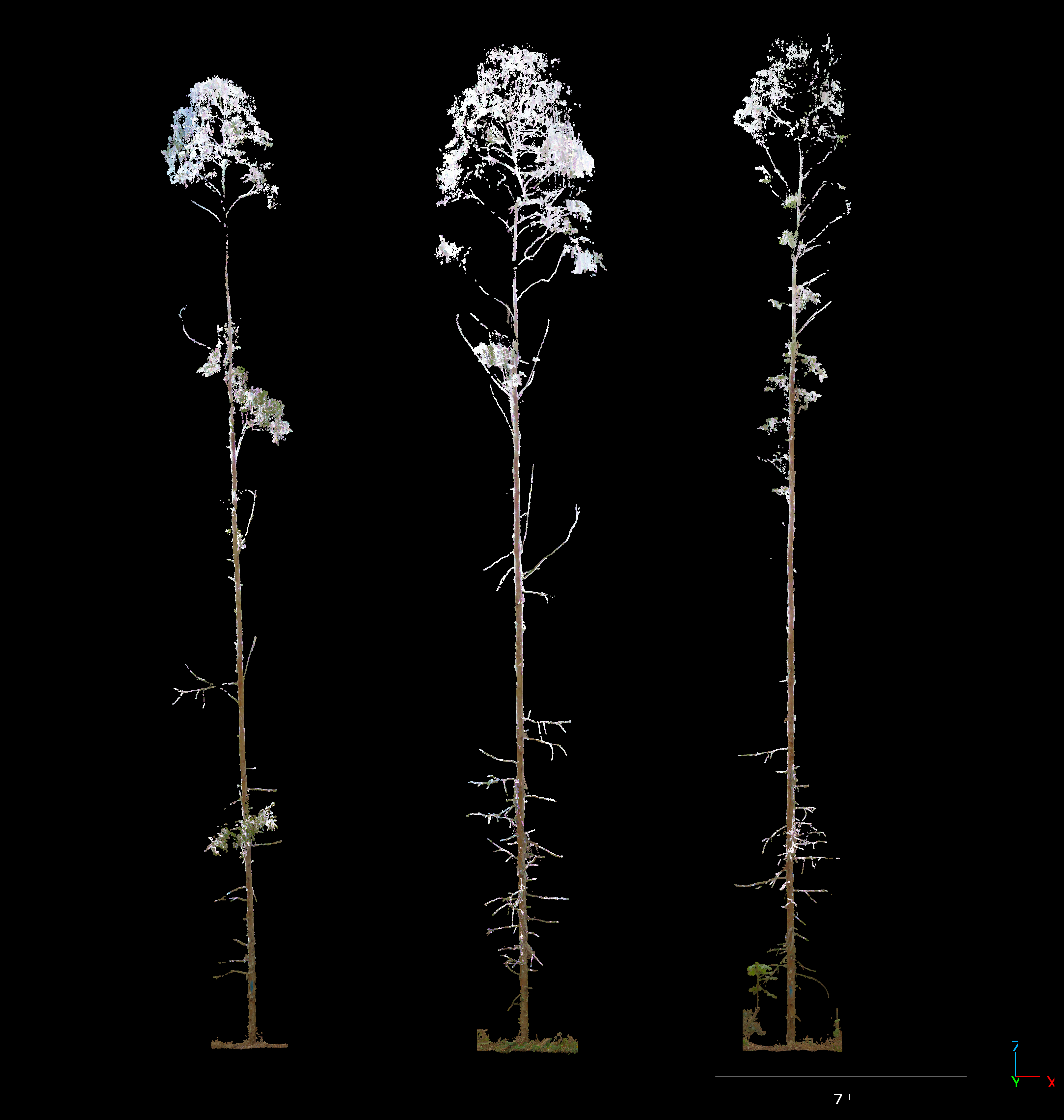
3D point cloud — every tree, every branch
What field work looks like
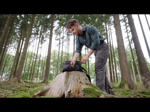
Bruno on site: one person, one scanner, one plot. ↗ Watch on YouTube
Your DFI dashboard
01
Map-based images
See where each plot sits in your stand, with results overlaid.
02
Workflow status
Which plots are done, in review, or ready.
03
360° plot images
Click and look around the plot as if you were standing there.
04
Inventory metrics
Volume, diameter distribution, height, and stocking analysis. Custom
boards available.
Tradicional vs. 44moles
|
Tradicional |
44moles |
| Tempo por parcela |
30 min |
1,5 – 5 min |
| Árvores medidas |
6 – 8 (amostra) |
25+ (todas) |
| Equipe necessária |
Várias pessoas, motosserras, corte |
Uma pessoa, um scanner, sem corte |
| Dados obtidos |
Planilha, um diâmetro por árvore |
Gêmeo digital, múltiplos diâmetros, 3D |
| Verificação |
Voltar à floresta |
Imagens 360° do seu escritório |
Uma varredura captura 80 árvores em 75 segundos. Os dados sobem
automaticamente. Você revisa os resultados no mesmo dia.
Equipes de campo são mais difíceis de gerenciar que árvores
Equipes saem. Medições variam de pessoa para pessoa. Atrasos por clima
custam tempo e dinheiro. Cada troca de equipe arrisca a qualidade dos
dados.
Com a 44moles
-
Equipes menores, mais trabalho. Uma pessoa com um
scanner substitui uma equipe completa.
-
Progresso em tempo real. O painel DFI mostra quais
parcelas foram varridas, enviadas e revisadas — ninguém precisa voltar
ao talhão.
-
Trabalho mais seguro. Sem motosserras, sem corte de
árvores, sem riscos de navegação.
Como são os dados
Varredura LiDAR em vista superior de uma parcela
Nuvem de pontos 3D — cada árvore, cada galho
Como é o trabalho de campo
Bruno no talhão: uma pessoa, um scanner, uma parcela. ↗ Assistir no
YouTube
Seu painel DFI
01
Imagens baseadas em mapa
Veja onde cada parcela está no talhão, com resultados sobrepostos.
02
Status do fluxo
Quais parcelas estão prontas, em revisão ou finalizadas.
03
Imagens 360° da parcela
Clique e olhe ao redor da parcela como se estivesse lá.
04
Métricas de inventário
Volume, distribuição de diâmetro, altura e análise de densidade.
Painéis personalizados disponíveis.